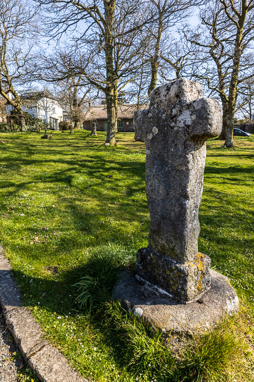
Bennett’s Cross and other crosses on Dartmoor
Within Dartmoor National Park there are 132 known crosses. Many were used as marking the footpaths along the often mist-covered moorland, some marked the medieval routes between abbeys. Others are used as memorials or market crosses and boundary markers. The oldest are probably around 1,000 years old, and the “youngest” were erected around 100 years ago.
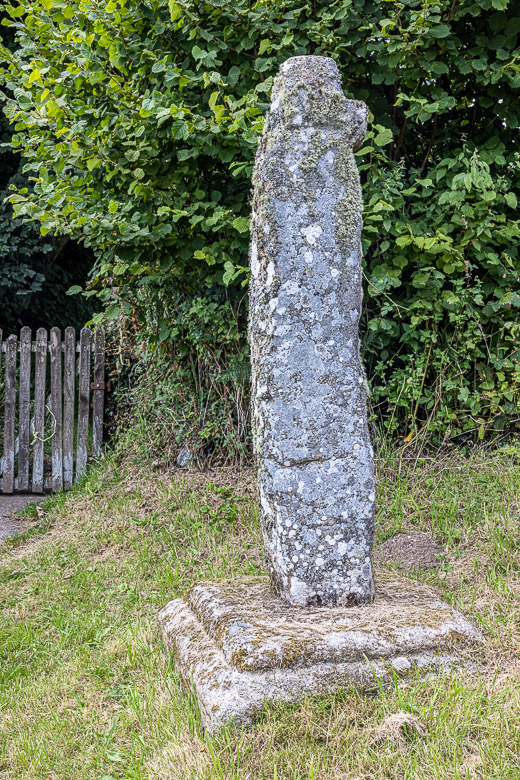
Bennett’s Cross is situated not far from Postbridge. It is quite crooked and very crudely done and is probably quite old. Travellers passing by has described it as being in agony. And the arms of the cross are quite small compared to many other crosses. It is believed that the cross was made of a menhir (a bronze age large, man-made standing stone)
The cross was the boundary stone for the parishes of North Bovey and Chagford. Later it also became the boundary stone for the Headland Warren. It has the letters WB carved into its west face and WB stands for Warren Boundary. The warren was supplying rabbit meat to the tinners working nearby at a the Vitifer Tin Mines, and the cross also became the boundary marker for the mines.
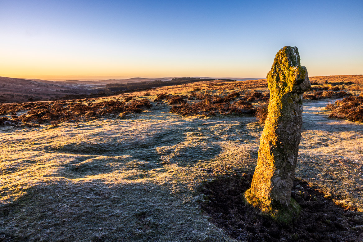
There are different explanations for the name. One is that it was named after a 16th century tin miner, William Bennet, who had the tin rights in the area. Another theory claims that it marked the route between the two Benedictine Monasteries at Exeter and Tavistock. The word “Bennet” or “Benet” being a medieval corruption of Benedictine.
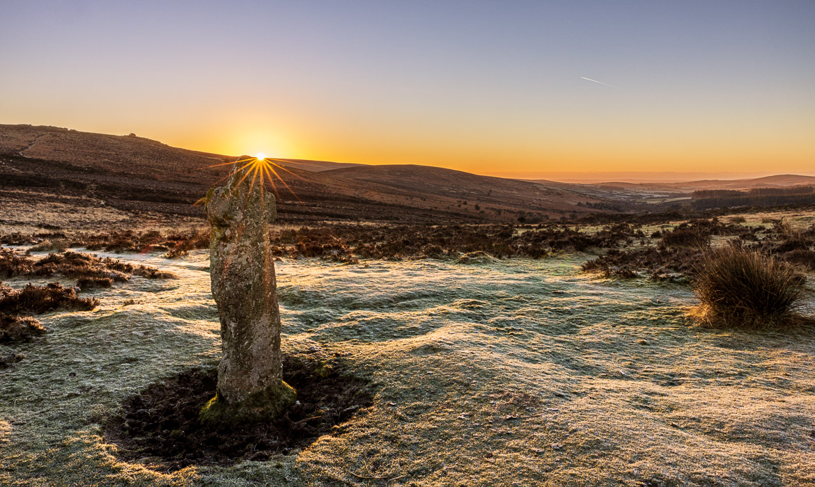
I passed Bennet’s Cross one early morning just before sunrise and saw the opportunity to catch the sun rising behind the cross and the moorland behind it. The second image shows the cross lit by the first sunrays. The other images below here are illustrations of other Dartmoor crosses that I have published before but demonstrates the variety of crosses on Dartmoor.
On the village green of North Bovey you can find an ancient stone cross. It was thrown down during the Civil War and was found again in a local stream and retrieved in 1829. However the cross looks older than its base, so it is now believed that it was actually another cross that was found and replaced the original. I have tried to photograph it, but one of the nuisances of modern life is that there are always cars parked around the green, spoiling a nice view of the cross. I have tried anyway, as you can see in the photo above on the left.
In 1908 a local man, working on the church bells at St Winnifred’s Church in Manaton, discovered on a walk an unusual stone used to carry a bridge across the stream and he could see a small cross incised into the stone. It was identified as a medieval cross and must originally have been erected outside the village, probably as a way marker. One arm of the cross is completely missing and the other is shortened. The Rector at the time had the stone installed on the socket of an earlier cross that disappeared (see image above to the right).
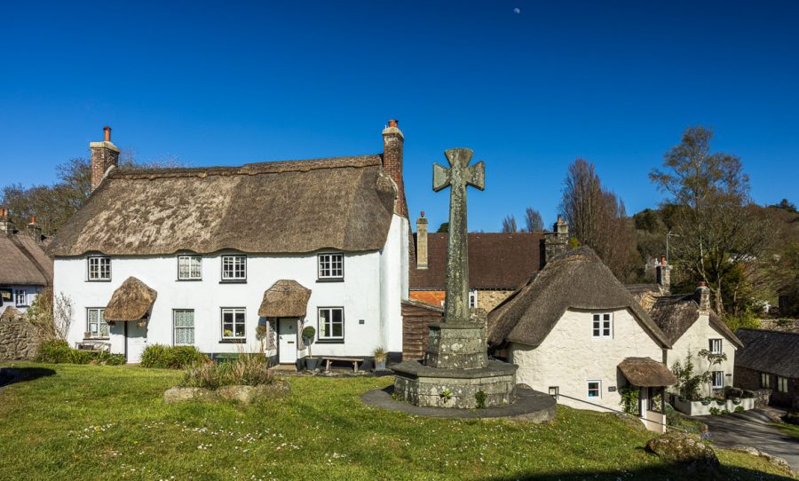
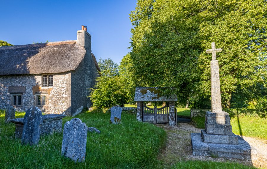
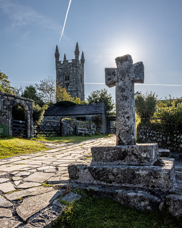
Above is a market cross on the village green at Lustleigh with its beautiful thatched cottages behind and below that a War Memorial at Manaton Church with the Church House to the left. And the right image shows the village cross outside St Leonard’s Church at Sheepstor, a tiny hamlet of around 50 inhabitants.
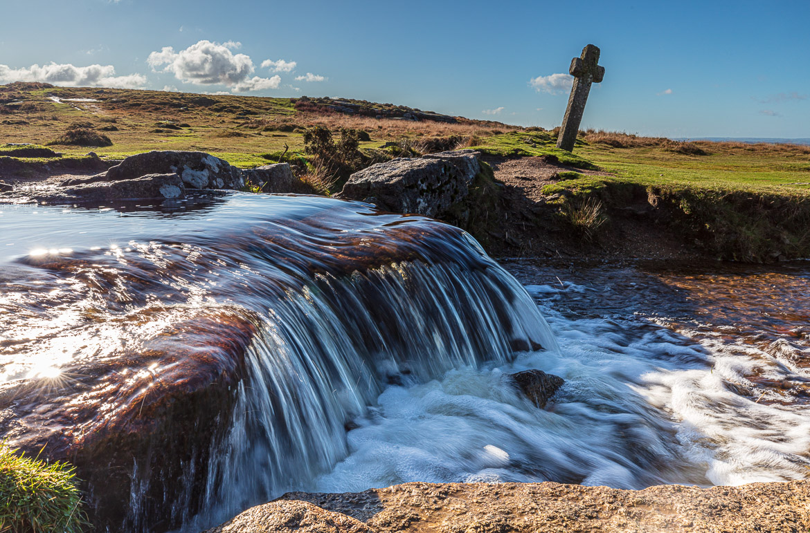
Grimstone and Sortridge Leat is a manmade leat or canal constructed more than 700 years ago (see the image below). It carried water to the manor houses of Grimstone and Sortridge and still supplies drinking water to around 35 houses.
At the leat there is a very attractive but also very small waterfall, and next to the waterfall is a granite cross leaning towards one side. The cross is called Windy Post, suggesting it has been blown aside causing it to lean. That is probably not the case. It is more likely that cows or sheep have pushed it aside. Its correct name is Beckamoor Cross.
The cross was erected in the 15th century, probably replacing an earlier one. It has likely been used as a marker on the monastic route between Buckfast and Tavistock Abbeys.