Legends and Reality
The Isles of Scilly are a group of 5 larger and 50 smaller islands or islets situated 28 miles west of Cornwall. They are both the most westerly and the most southernly outposts of England. Until relatively recent times the islands were much larger and probably joined together into one island named Ennor. The whole of southern England has been steadily sinking since the last ice age, whereas Scotland and Scandinavia are rising as the glaciers in the north retreated and later disappeared after the ice age.
A description written during Roman times describes Scillonia Insula in the singular, indicating either a single island or an island much larger than any of the others. Remains of a prehistoric farm have been found on a small rocky skerry far too small to harbour a farm, so it must have been a much larger land area belonging to that farm. Rising sea levels flooded the central plain between the islands around 400 – 500 AD forming the current islands.
Lyonesse was a kingdom that according to legend stretched from Land’s End at the southwestern tip of Cornwall to the Isles of Scilly. I have told about Lyonesse in my earlier post about Land’s End. It was lost after being swallowed by the sea in a single night. It had a cathedral that was said to have been built on top of what is now called the Seven Stones Reef, 18 miles west of Land’s End and east of the Isles of Scilly.
It is an Arthurian legend, but stories about a sunken kingdom appears among all Celtic peoples, the Celts in Cornwall as well as in Brittany (Bretagne) and in Wales, although the different cultures place the island and kingdoms at slightly different places. Some have speculated that it could be the sunken kingdom of Atlantis.
My Visits
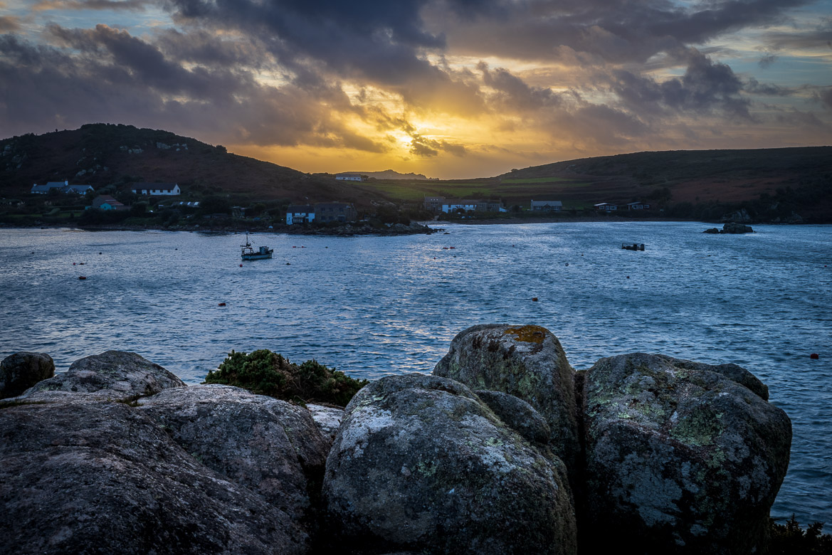
I visited the islands the first time in 2005 onboard Adèle, when we (my daughter Ulrika and I and some friends and the crew) anchored in the sound between St Mary’s and Tresco and Samson. Adèle was far too big to get into any of the smaller and more protected anchorages, and we ventured ashore to the different islands with our tenders. I came back in summer 2010 with my family (Jennifer, Mikee and Eric) and then again in November 2022, when I joined a photo group for a few days.
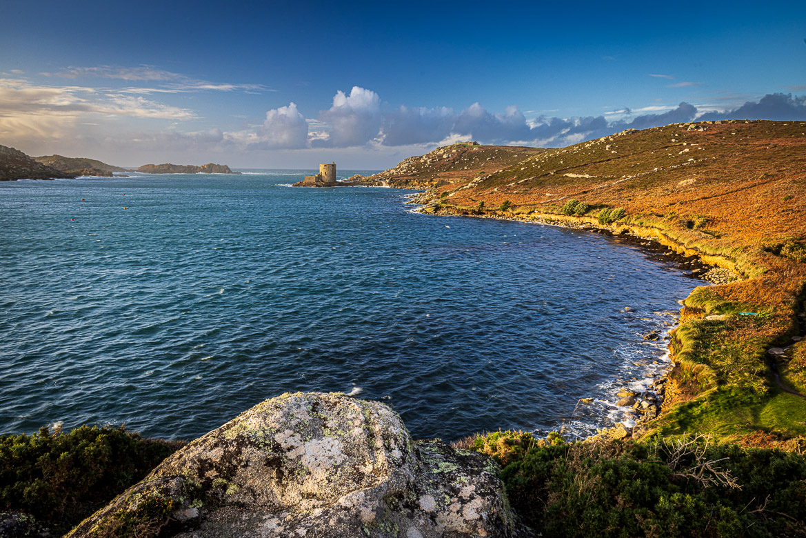
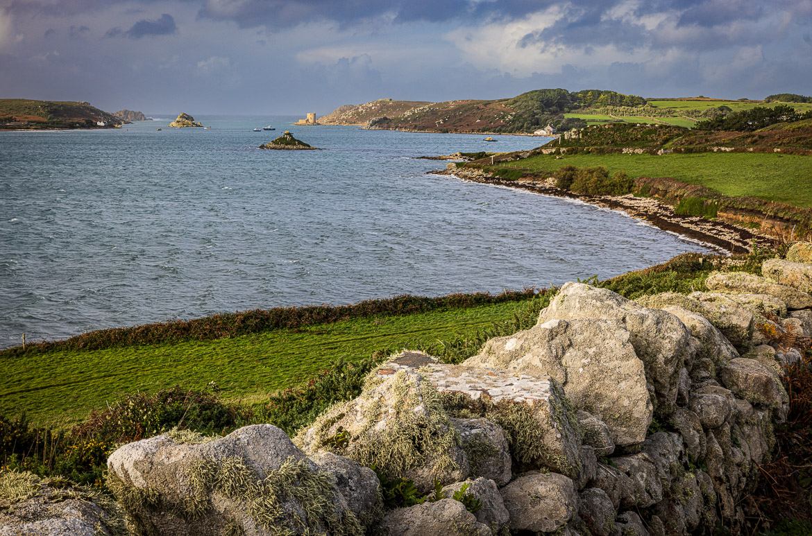
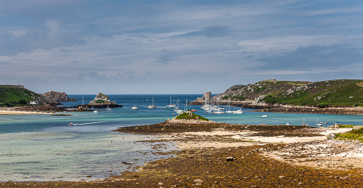
The last two trips focused on two of the main islands, Tresco and Bryher, although we also visited St Mary’s. My photos in this first post from the Isles of Scilly are all from the shallow sound between Bryher and Tresco that runs view in a north-south direction. They are all taken from the island of Tresco.
The following two images were both taken in 2010 from a similar viewpoint as the first photo on this post, which was captured in November this year. But they were taken at the middle of the day and Mikee (7 years old) joined me on several of my photo walks, so I had to limit my walks to daytime.
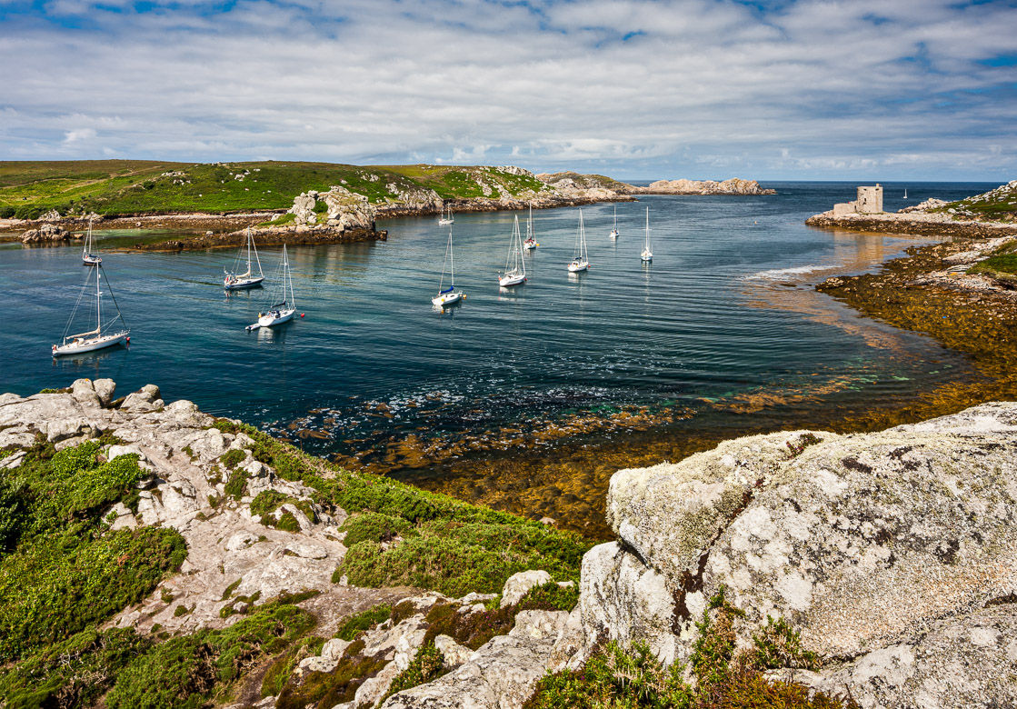
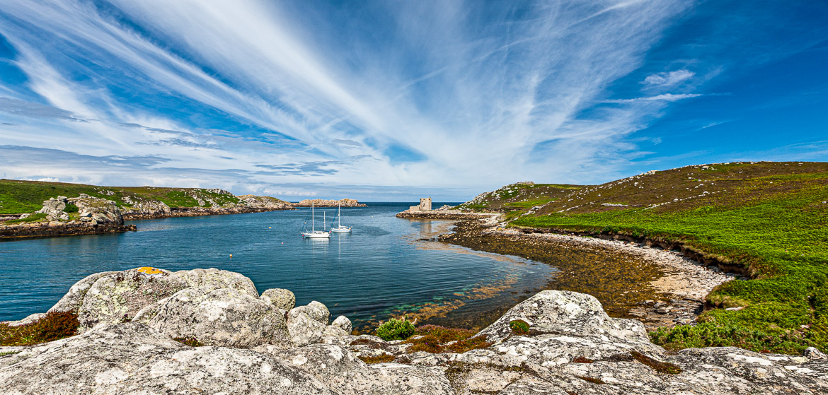
The Sound between Tresco and Bryher
The sound is an excellent anchorage (although it was too shallow for Adèle) and is much used by yachts during the summer. In the not distant past, it was also used a lot by the fishing boats and during the Second World War it was the base for many clandestine missions to France by boat. When in British waters these boats were painted grey to blend in with the other naval boats, but when on secret missions to France they would be repainted in bright colours to resemble a Breton fishing vessel.
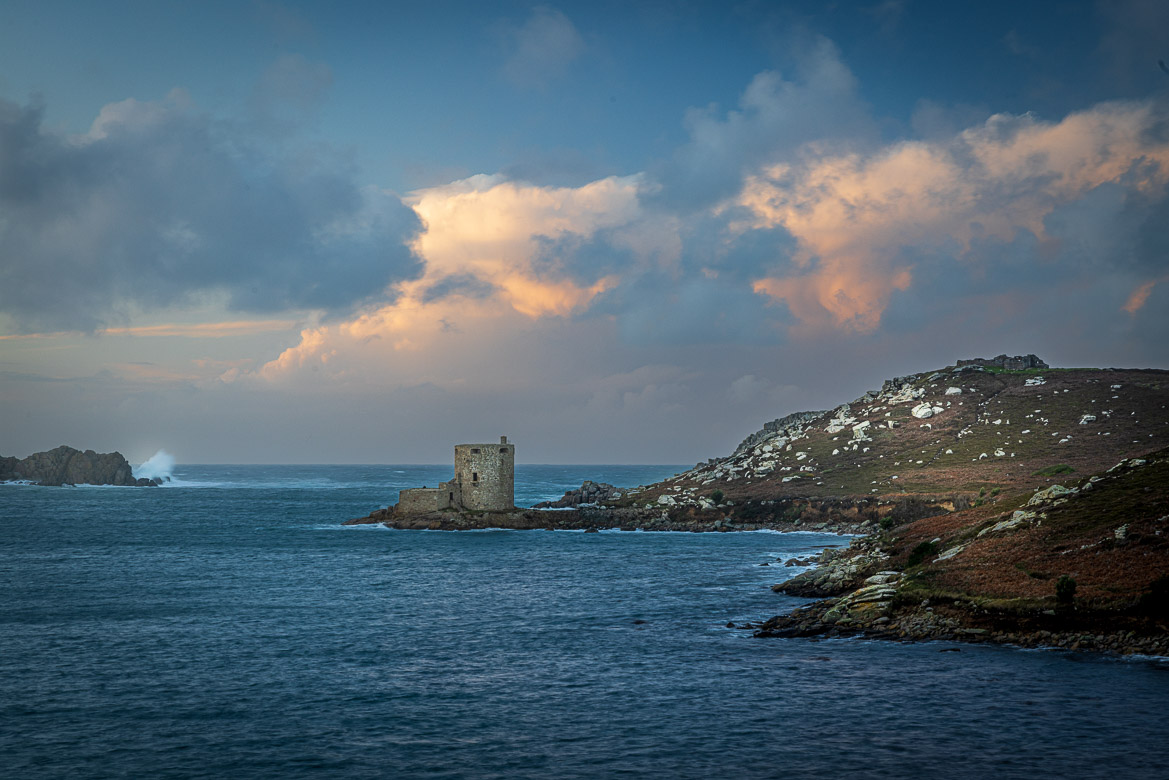
Cromwell’s Castle
At the north end of the sound on a rocky promontory on the Tresco side stands a round tower built in 1651 to protect the anchorage. It is one of the few remaining Crowellian fortifications in Britain. The Royalists held out on the Isles of Scilly for much of the Civil War period, but in 1651 the Parliamentarians took the isles and fortified the anchorage by building Cromwell Tower protecting the northern entrance to the anchorage.
The fort was considered worth updating a century later, when a platform for cannons was added on the seaward side (can be clearly seen on several of my photos).
In the coming posts I will tell more stories and post more images from Tresco and Bryher.